Client: Geological Survey Ireland
Key Facts:
Groundwater flooding represents a significant flood hazard for many rural communities and is a primarily associated with lowland karst in the west of the country.
Due to the unprecedented flood events of 2009 and 2016 the GSI were in position to establish a three year project monitoring, modelling and mapping turloughs.
This project provides fundamental technical knowledge to enable OPW and local authorities to develop appropriate flood mitigation measures and allow for informed flood assessments to be made in the future.
One Planet Principles:
- Sustainable water,
- Land Use and Wildlife
- Health and Happiness
Project Sustainability:
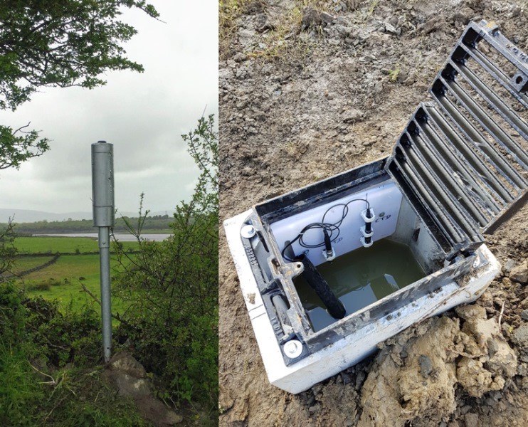
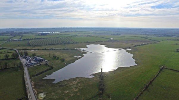
Groundwater flooding in Ireland is primarily associated with turloughs, seasonal lakes which are found in lowland karst groundwater flow systems. These lakes typically flood on an annual basis due to winter rainfall and increased groundwater levels and over 500 are known to exist, primarily located on the pure bedded limestone lowlands in counties Roscommon, Galway, Clare and Mayo. The Geological Survey, in collaboration with Trinity College Dublin has developed a monitoring, mapping and modelling programme to address the knowledge gap regarding these complex karst systems.
Due to the unprecedented flood events of 2009 and 2015 flood risk management is a serious challenge faced by communities. In response to the 2015 flooding specifically related to turloughs, the Programme for Partnership Government (2016) contains the following objective: “Turlough systems: We will provide resources to the OPW to commission studies into individual problematic (prone to flooding) Turlough systems, if requested by a local authority or another relevant State agency”.
Primary objectives of the project are:
- Establish a permanent monitoring network to provide long-term quantitative groundwater flooding data.
- Develop methodologies for improving groundwater flood hazard maps and real-time monitoring of groundwater flooding.
- Develop modelling/analysis methodologies for estimating groundwater flood frequency and the assessment of potential flood mitigation strategies.
- Analyse the potential impact of climate change on turlough hydrological functioning and groundwater flooding.
- Produce a groundwater flood hazard map of Ireland on behalf for the CFRAM Programme.
The GSI is temporarily monitoring over 60 turloughs with an additional 20 permanent sites for real-time monitoring. This project is about long term sustainability of the people and their communities and provides an advisory service in relation to groundwater flooding in terms of solutions. Importantly protecting turloughs unique flora and fauna which many are protected as Special Areas of Conservation by the EU Habitats Directive and ‘Groundwater dependent terrestrial ecosystems’ by the EU Water Framework Directive. This project is important with respect to sustainability protecting wildlife and its land use.